We are going to analyse the topography of the place, with the purpose of developing a map of different uses that can take place on the site. It would be a manual of instructions of how to operate in the landscape without changing its essence.
Change of scale, change of speed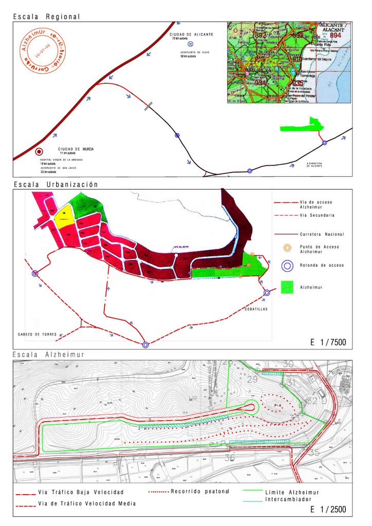
A study of three different scales allows a progressive approach towards the land. It begins with a scale of the region, appraising the relationship of the site with the adjacent towns and cities, to the scale of AlzheimUr, much more detailed that describes the possible planning of traffic inside the site. From the intermediate scale, the scale of the housing estate, emerge new accesses to the site. The quick access from the lowest part of the site through the National road will help making the traffic through the housing estate more fluid. Another third access to the north is also possible. In order to obtain a fluid traffic, these routes help defining the different types of users depending on the different accesses, and reserving some of the accesses to the personnel or the arrival of goods.
Diagnosis of the structure
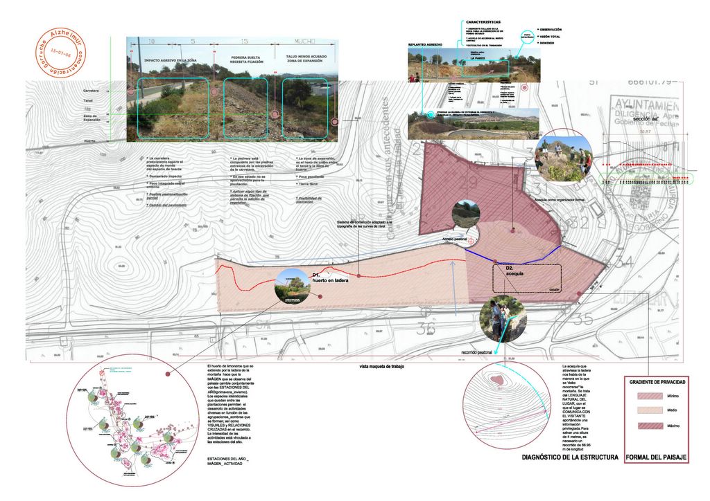
The topography determines the degree of intimacy offered by the site. There are different degrees of privacies, from the minimum to the maximum. Such a powerful topography forces any kind of a building to adapt to its form. We can distinguish variations within the slope and we have made a first study of three areas: the first is the road from the housing estate that makes a great visual impact; the second is stone gravel that has been left there from making the mentioned road, instable and more complicated to work with. The third area is flat and fertile and could be used for planting. Furthermore, it is important to bear in mind the possibilities offered by the existing irrigation ditch and the orchard of lemon trees. The irrigation ditch can be understood as a guide to move through the place. In terms of the orchard, it offers us changing images according to the seasons, as well as different visual lines and crossing relationships.
Surprising atmospheres
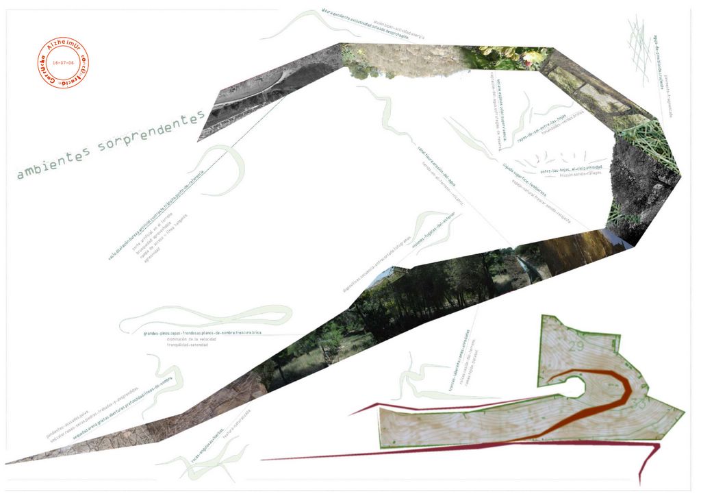
We are going to climb the mountain in order to explore the different kinds of atmospheres. Immediately, we sense the steep slopes starting to indicate dryness, sandy air, and cracks in the sand. The opening to the pine wood leads to a dense vegetation that makes us reduce the speed of walking and arouses tranquillity and serenity, besides to offer fleeting visions of the outside. The labyrinth of trunks of the pine trees acts as a web of parasols. More ahead, an irrigation ditch appears. Advancing a little more, the atmosphere is dry, something that makes us think about ways of reserving and keeping water. As we reach the peak, the slope increases and at the same time, the uniqueness: we arrived at a sunny place but unprotected. In front of us we are left to emptiness, an artificial void of the land that is rough but also attractive to use in some way.
Stimulating the senses
Stimulating the senses
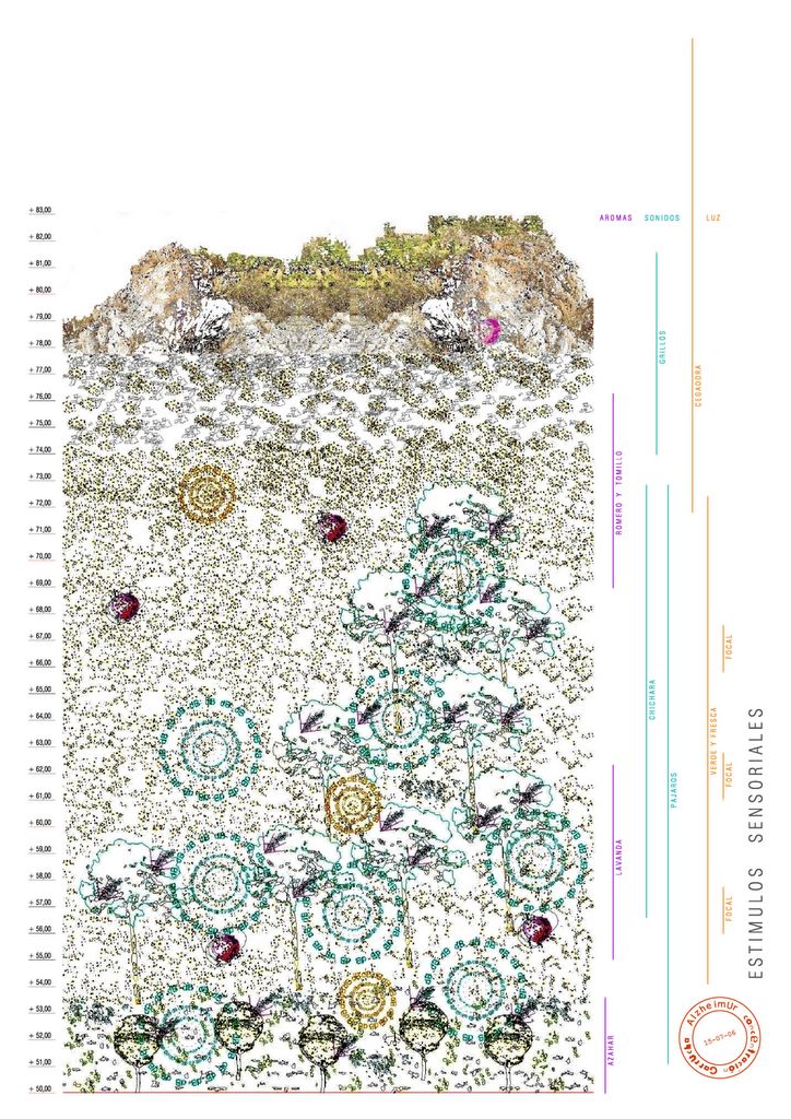
Going up the mountain suggests a change of aromas, change of sounds and light. They are all sensorial elements that are characteristic for the region: the orange blossom, the Rosemary, cicada, the song of the birds, the green and fresh light … We appreciate these changes very much not least because they correspond to the essence of the site. Their conservation is essential to recover the memory of the site.


No comments:
Post a Comment